
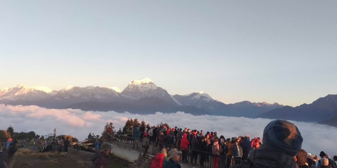
Mount Dhaulagiri
Summary: Mount Dhaulagiri, the seventh-highest mountain in the world at 8,167 metres, carries a 16-18% fatality rate, among the highest of any eight-thousander. Its northeast ridge route demands sustained technical climbing through serac fields and avalanche zones, with rescue above base camp nearly impossible. Remote, minimally commercialised and logistically isolated, Dhaulagiri suits only experienced mountaineers with prior 8000m expedition experience, not first-time high-altitude climbers.
Understanding Mount Dhaulagiri
Mount Dhaulagiri rises to 8,167 metres in western Nepal, making it the seventh-highest mountain in the world. The name comes from Sanskrit, meaning “white mountain“, and climbers who’ve attempted it understand why. It’s not just the altitude that defines Dhaulagiri; it’s the exposure, the weather, and the terrain that make experienced mountaineers think twice before booking an expedition.
For decades, Dhaulagiri was thought to be the highest mountain in the world until surveys in the mid-1800s confirmed Everest held that title. Still, Dhaulagiri wasn’t first climbed until 1960, making it one of the last 8000-metre peaks to be summited. That late first ascent wasn’t due to lack of interest; it was because the mountain is genuinely difficult to climb.
Today, Dhaulagiri remains one of the least commercialised peaks in Nepal, attracting serious climbers rather than guided tour groups. Its fatality rate, technical demands, and logistical isolation keep traffic low, making it a mountain approached with caution and respect. This guide, prepared with experience from Nepal Hiking Adventure, explains what makes Dhaulagiri severe, who should consider climbing it, and the routes to Dhaulagiri for those ready to attempt one of the Himalayas’ hardest challenges.
Mount Dhaulagiri at a Glance: Facts, Location and First Ascent
What is Mount Dhaulagiri? Height, Global Ranking and Key Facts
Dhaulagiri is the seventh-highest mountain in the world, standing tall at 8,167 metres (26,795 feet) and one of the highest and most formidable objectives in high-altitude mountaineering. It is part of the Dhaulagiri massif, a concentrated cluster of major summits in the Dhaulagiri region of western Nepal.
| Peak | Elevation |
| Dhaulagiri I (main summit) | 8,167 m / 26,795 ft |
| Dhaulagiri II | 7,751 m / 25,430 ft |
| Dhaulagiri III | 7,715 m / 25,310 ft |
| Dhaulagiri IV | 7,661 m / 25,135 ft |
| Dhaulagiri V | 7,618 m / 24,993 ft |
The main peak dominates the skyline above the Kali Gandaki Valley to the east, with a vertical relief so pronounced that it generates its own weather systems. Storms develop quickly, high winds persist year-round, and the alpine environment above 7,000 metres offers little margin for error. Unlike Mount Everest, which has extensive commercial infrastructure, Dhaulagiri mountain remains logistically bare and unforgiving.
Key facts at a glance:
- Global rank among 8,000-metre peaks: 7th highest mountain in the world
- Location: Myagdi district, western Nepal
- Known for: rapid weather changes, serious avalanche risk, and sustained technical difficulty
- Visually dominant from the Annapurna Circuit, though the view from below gives little indication of what the climb demands

Where Exactly is Dhaulagiri Located in Nepal?
This mountain in Nepal sits in a remote part of Nepal, roughly 200 kilometres northwest of Kathmandu, lying west of the Annapurna massif and separated from it by the Kali Gandaki Gorge, one of the deepest valleys on earth. Pokhara serves as the staging point for most expeditions, with teams trekking to Dhaulagiri Base Camp at a height of 5,300 m before any technical climbing begins. The approach crosses the Dhampus Pass, a high glacier col that is itself demanding and serves as the gateway to the mountain’s northern flanks.
| Feature | Detail |
| Country | Nepal |
| District | Myagdi |
| Nearest city | Pokhara |
| Base Camp elevation | 5,300 m / 17,388 ft |
| Separation from Annapurna | Kali Gandaki Gorge |
| Distance from Kathmandu | Approx. 200 km northwest |
The mountain’s position in the monsoon transition zone shapes the climbing calendar. Storms roll in from the south with little warning, and the Dhaulagiri massif creates a rain shadow that leaves the northern approaches drier but far more exposed to wind.
When and How Was Mount Dhaulagiri First Climbed?
Dhaulagiri was first summited on May 13, 1960, by a Swiss-Austrian expedition led by Max Eiselin. It was the last of the fourteen 8,000-metre peaks to be climbed, a distinction that reflects how long the mountain resisted serious attempts.
| Climber | Role |
| Max Eiselin | Expedition leader |
| Kurt Diemberger | Summit team |
| Peter Diener | Summit team |
| Ernst Forrer | Summit team |
| Albin Schelbert | Summit team |
| Nawang Dorje (Sherpa) | Summit team |
| Nyima (Sherpa) | Summit team |
The expedition is notable for several reasons:
- A small aircraft was used to establish high camps, though it crashed during the attempt.
- The team adapted and reached the summit via the northeast ridge, which remains the standard route today.
- The ascent required months of preparation, multiple camps, and careful acclimatisation.
Early teams consistently underestimated the technical demands of the upper mountain, particularly the avalanche risk and the complexity of navigating the glacier systems below. The first ascent proved that Dhaulagiri required not simply high-altitude endurance but genuine alpine climbing ability.

The Geography of Mount Dhaulagiri: Why the Mountain Is So Severe
Faces, Ridges and Vertical Relief
Views of Dhaulagiri from the valley reveal a mountain of extraordinary structural severity. From the Kali Gandaki Valley at roughly 1,200 metres, the mountain rises over 7,000 metres to the summit, creating weather gradients that can turn lethal within hours. Views of Mount Dhaulagiri from the valley floor give some sense of scale, though they can never fully convey the technical complexity of the upper ridges.
| Feature | Description | Impact on Climbing |
| North Face | Massive ice and rock wall | Rarely attempted, extremely dangerous |
| East Face | Steep mixed terrain, serac-threatened | Not part of standard routes |
| Northeast Ridge | Exposed and technical above 7,000m | Main climbing line, still hazardous |
| Vertical Relief | Over 7,000m from valley to summit | Creates severe weather, rapid altitude gain |
Key structural hazards:
- The north face presents a near-vertical wall most teams avoid entirely.
- Hanging glaciers and serac fields on the east face calve without warning.
- The northeast ridge, while the most climbed line, remains exposed to objective hazards throughout.
- Upper sections require technical skills across mixed rock, ice and snow.
The peak’s isolation creates microclimate systems that intensify storms. Wind speeds exceeding 100 km/h have been recorded during supposedly calm weather, and temperature inversions produce conditions that defy forecasting. Climbers must be prepared to descend rapidly when the mountain turns.


How Glaciers and Icefalls Shape Movement
Glacier systems on Dhaulagiri dictate route options and timing across every elevation band.
| Glacier Zone | Altitude Range | Primary Dangers |
| Lower Glacier Approach | 4,500–5,500 m | Hidden crevasses, glacier movement |
| Dhaulagiri Icefall | 5,500–6,200 m | Serac collapse, route changes |
| Mid-Mountain Glacier | 6,200–7,000 m | Avalanche, exposed traverse |
| Upper Glacier Systems | 7,000–8,16 7m | Extreme cold, wind-slab |
Glacier movement can render routes impassable overnight, and fixed ropes frequently fail as ice shifts and anchors pull free. Above 7,000 metres the terrain stabilises somewhat, but avalanche risk increases sharply after storms, and conservative assessment of snow conditions is not optional. It is survival knowledge.
Dhaulagiri and the Himalayan Landscape Around It
The Massif and Its Surrounding Peaks
The Dhaulagiri massif forms a natural barrier that isolates the main mountain from easy access. As part of the broader Himalayan mountain range, the surrounding peaks range from occasionally attempted to virtually untouched, each carrying technical grades that reflect genuine difficulty rather than marketing. Dhaulagiri I stands as the highest peak within the massif and dominates every approach.
| Peak | Height | Technical Grade | Climbing Frequency |
| Dhaulagiri I | 8,167 m | ED (Extremely Difficult) | Most attempted |
| Dhaulagiri II | 7,751 m | TD+ (Très Difficile Plus) | Occasional |
| Dhaulagiri III | 7,715 m | ED (Extremely Difficult) | Rare |
| Dhaulagiri IV | 7,661 m | ED+ (Extremely Difficult Plus) | Very rare |
| Dhaulagiri V | 7,618 m | TD+ (Très Difficile Plus) | Very rare |
The massif creates complex weather patterns as storms funnel through valleys and intensify on exposed ridges. Trekkers completing the Dhaulagiri circuit trek witness this dramatic landscape firsthand and gain a more honest sense of the mountain’s scale than any photograph provides.
Relationship to Annapurna and the Kali Gandaki Gorge
The Kali Gandaki Gorge drops over 5,500 metres between the valley floor and the surrounding peaks, acting as a natural wind tunnel that funnels monsoon systems northward from the Indian plains. The mountain becomes completely unclimbable from June through September, and even the approach seasons require careful weather assessment.
Among the treks in Nepal, the Dhaulagiri circuit stands apart for its remoteness and physical commitment. Trekkers on the Annapurna Circuit can see Dhaulagiri clearly across the gorge and are rewarded with breathtaking views of the massif that no road or village approach can replicate. The Dhaulagiri circuit trek, by contrast, is longer, harder and far more remote. Those who complete it gain a genuine appreciation for the mountain’s isolation and the commitment required simply to reach its base.
Why Dhaulagiri Stands Apart Geographically
Unlike Everest or Annapurna, Dhaulagiri sits without shared infrastructure or established commercial corridors. Everything must be carried in from Pokhara. Helicopter support is limited by terrain and weather. Emergency evacuation above 6,500 metres is nearly impossible. Expeditions must be fully self-sufficient in ways that are simply not required on more commercialised mountains, and this fact alone separates the climbers who attempt Dhaulagiri from those who do not.

A Brief History of Mount Dhaulagiri Expeditions
Early Reconnaissance and Failed Attempts
Before the 1960 success, a succession of expeditions tried and failed, each adding to the mountain’s formidable reputation. For much of the early twentieth century, Dhaulagiri was believed to be the highest mountain in the world, a distinction that only added to the urgency and prestige attached to climbing it.
| Year | Expedition | Outcome | Highest Point |
| 1950–1956 | French teams | Multiple failures | ~7,000 m |
| 1958 | Swiss | Retreat | 7,400 m |
| 1959 | Austrian | Casualties | 7,800 m |
| 1960 | Swiss-Austrian | First ascent | 8,167 m |
The Dhaulagiri icefall proved particularly deadly in the early years. Technical challenges exceeded both the equipment and the experience available at the time, and by the late 1950s the mountain was widely considered one of the most difficult unclimbed peaks in the world. Every team that attempted to climb the mountain before 1960 was turned back by terrain that simply exceeded what they had prepared for.
The 1960 Breakthrough and Climbing Evolution
The success in 1960 hinged on methodical preparation, systematic camp placement, and genuine respect for the mountain’s power. Max Eiselin’s team spent weeks acclimatising properly and executed the summit push on 13 May within a narrow weather window, descending quickly before conditions deteriorated. That date stands as one of the most significant in high-altitude climbing history, marking the moment Dhaulagiri finally yielded to a team prepared to meet it on its own terms.
Since then, success rates have improved, but the mountain has not become easier.
| Era | Climbing Style | Success Rate | Key Development |
| 1960s–1970s | Traditional siege | ~15% | Large teams, extensive fixed ropes |
| 1980s–1990s | Alpine-style emergence | ~20% | Smaller teams, faster ascents |
| 2000s–2010s | Mixed approaches | ~25% | Better weather forecasting |
| 2010s–present | Varied strategies | ~30% | Some commercial operators |
The fatality rate remains approximately 16–18% of summit attempts, a figure that has not shifted significantly despite advances in equipment and forecasting. The mountain’s fundamental danger is structural, not technological.
Why Mount Dhaulagiri Is Considered One of the Most Dangerous 8000ers
Objective Hazards: Avalanches, Seracs and Unstable Faces
Dhaulagiri’s objective hazards are constant and, in many cases, cannot be avoided. They can only be managed.
| Hazard | Fatal Incidents (%) | Primary Risk Zones |
| Avalanche | 35–40% | Upper mountain, steep faces |
| Serac collapse | 20–25% | Icefall, Camp 2 vicinity |
| Crevasse falls | 5–10% | Glacier approach, icefall |
| Rockfall | 5–8% | Mixed terrain zones |
| Altitude effects | 15–20% | Death zone above 7,500m |
The upper mountain has multiple slopes above 35 degrees that avalanche after snowfall with little warning. Hanging ice formations above camps can collapse without any preceding sign, and many fatalities occur not during the summit push but while climbers rest in their tents. The northeast ridge passes beneath serac bands that have killed multiple teams across the decades.

Altitude, Weather Volatility and Summit Windows
| Altitude Zone | Key Risks | Oxygen Saturation |
| Below 6,000m | Crevasses, mild altitude | 85–95% |
| 6,000–7,000 m | Weather, avalanche | 75–85% |
| 7,000–8,000 m | Hypoxia, extreme cold | 60–75% |
| Summit push | All factors combined | 50–60% |
Summit windows on Dhaulagiri are shorter than those on Everest, typically three to five days per season against Everest’s seven to ten. The physiological demands of sustained high-altitude exposure compound every other risk: sudden temperature drops from -20°C to -40°C within hours and wind speeds regularly exceeding 80–120 km/h mean that expeditions must sometimes commit to summit attempts on marginal forecasts or not at all. Many experienced teams wait weeks without a viable window and return home without a summit bid.
Fatality Rate in Context
| Peak | Fatality Rate | Total Summits | Risk Category |
| Mount Annapurna | 20–22% | ~300 | Extreme |
| Mount K2 | 22–25% | ~450 | Extreme |
| Dhaulagiri | 16–18% | ~500 | Very High |
| Nanga Parbat | 20–22% | ~350 | Extreme |
| Everest | 4–5% | 6,000+ | Moderate |
| Cho Oyu | 1–2% | 4,000+ | Low |
Roughly one in six climbers who attempt the summit do not return. Dhaulagiri kills experienced mountaineers with multiple 8,000-metre summits on their record. The mountain does not discriminate by experience, and it punishes mistakes and bad luck with equal indifference. Remote location limits helicopter access above base camp, and survival rates after serious injury above 6,500 metres are extremely low.
Main Climbing Routes on Mount Dhaulagiri Explained
The Northeast Ridge: The Standard Route
The northeast ridge is the original route to Dhaulagiri, established during the first ascent in 1960 and still the most logical line to the summit. Those who climb Dhaulagiri today follow roughly the same line that Eiselin’s team pioneered, with the addition of modern fixed ropes and improved forecasting.
| Camp | Altitude | Technical Grade | Key Features |
| Base Camp | 4,750 m | Non-technical | Staging area, acclimatisation |
| Camp 1 | 5,900 m | Moderate–Difficult | Above icefall, exposed |
| Camp 2 | 6,400 m | Difficult | Lower northeast ridge |
| Camp 3 | 7,400 m | Very Difficult | High-altitude camp |
| Summit | 8,167 m | Extremely Difficult | 10–14 hour round trip |
Technical demands include fixed ropes through the icefall, rope work above Camp 2, and sustained mixed terrain on the upper mountain. The summit ridge is knife-edged in places with exposure on both sides. “Standard” in this context means most frequently attempted, not straightforward or safe.
Alternative Routes and Why They Are Rarely Climbed
| Route | First Ascent | Difficulty | Attempts/Decade |
| French Pass | 1975 | ED+ | 5–10 |
| South Pillar | 1981 | ED+ | 2–5 |
| West Ridge | 1978 | ED | 1–3 |
| North Face | 1985 | ED+ to ABO | Under 5 |
The north face is among the most dangerous walls in the Himalayas, with constant avalanche and icefall danger and a success rate below five percent. The French Pass route crosses a high col west of the northeast ridge, is technically harder throughout, and is occasionally chosen by alpinists seeking a more demanding line. All alternative routes dramatically increase the risk profile relative to the already sobering numbers of the standard route.
How Route Choice Affects Survival Probability
| Route Type | Total Time | Summit Window | Survival Rate |
| Northeast Ridge | 6–8 weeks | 3–5 days | 82–84% |
| French Pass | 7–9 weeks | 2–3 days | 80–85% |
| Alternative Routes | 8–10 weeks | 1–2 days | 75–90% |
Patient acclimatisation, multiple rotations to high camps, and a genuine willingness to turn back separate survivors from statistics on this mountain. Those who summit Dhaulagiri via any route join a small group of mountaineers who have met the mountain’s terms entirely on its own ground.
Who Can Climb Mount Dhaulagiri Today?
The Experience Profile Required
Dhaulagiri is not the first 8,000-metre peak. Most expeditions recommend prior experience on peaks such as Cho Oyu, Manaslu, or Everest before attempting it. The physical fitness demanded goes beyond standard endurance training. Candidates must sustain technical output over six to eight weeks while managing progressive hypoxia, cold, and the psychological weight of sustained objective danger.
| Preparation Level | Recommended Experience | Success Probability | Risk Level |
| Beginner | No 8,000m experience | Under 5% | Extreme danger |
| Intermediate | 1–2 other 8,000m peaks | 15–25% | Very high risk |
| Advanced | 3+ other 8,000m peaks, strong alpine background | 30–40% | High risk |
| Expert | 5+ eight-thousanders, winter or technical route experience | 40–50% | Significant risk |
Essential skills include alpine climbing on mixed terrain and steep ice, proven decision-making under stress and hypoxia, self-rescue capability, and the physical conditioning to sustain effort across six to eight weeks at altitude.
Why Commercial Traffic Remains Low
| Peak | Guided Expedition Cost | Success Rate | Death Rate |
| Everest | $45,000–$90,000 | 60–65% | 4–5% |
| Dhaulagiri | $35,000–$50,000 | 25–30% | 16–18% |
| Mount Cho Oyu | $30,000–$45,000 | 70–80% | 1–2% |
Commercial operators cannot guarantee client safety at a 16–18 percent fatality rate. The pool of qualified clients willing to climb Dhaulagiri is small, the expedition duration pushes costs up, and the minimal infrastructure means no logistical shortcuts are available. Dhaulagiri remains a serious mountaineer’s mountain.
Common Reasons Expeditions Turn Back
| Reason | Frequency | Notes |
| Weather | 40–50% | Storms, high winds, short windows |
| Altitude sickness | 20–25% | HAPE, HACE, poor acclimatisation |
| Objective hazard | 15–20% | Avalanche risk, serac threat |
| Injury or illness | 10–15% | Frostbite, exhaustion |
| Route conditions | 5–10% | Impassable icefall, unstable snow |
Most expeditions turn back before the summit. This is often the correct decision. Experienced mountaineers understand the mountain will remain, and surviving to attempt again is better than summiting and not coming home.
Dhaulagiri Compared to Other Major Himalayan Peaks
Dhaulagiri vs Everest
| Factor | Everest | Dhaulagiri |
| Height | 8,849 m | 8,167 m |
| Fatality rate | 4–5% | 16–18% |
| Infrastructure | Extensive | Minimal |
| Rescue options | Helicopter to 7,000m | Limited above base camp |
| Technical climbing | Moderate | High throughout |
| Commercial traffic | 500–800/year | 50–100/year |
Despite being 680 metres shorter, Dhaulagiri requires more sustained technical climbing, offers no meaningful rescue infrastructure above Camp 2, and carries a fatality rate roughly four times higher. Climbers who have done both consistently rate Dhaulagiri as the harder mountain.
Dhaulagiri vs Annapurna
| Aspect | Annapurna | Dhaulagiri |
| Fatality rate | 20–22% | 16–18% |
| Avalanche danger | Extreme, unpredictable | High, somewhat predictable |
| Technical difficulty | Moderate with deadly sections | High throughout |
| Expedition length | 5–6 weeks | 6–8 weeks |
| Summit success rate | ~35% | ~30% |
Annapurna kills at a higher rate per attempt, but its danger is more concentrated in objective hazard. Dhaulagiri’s danger is more sustained and technical throughout. Neither should be attempted without extensive prior experience on other eight-thousanders.
Where Dhaulagiri Fits in a Logical 8000m Progression
| Stage | Peaks | Success Rate |
| Introduction | Cho Oyu, Mount Manaslu | 60–70% |
| Intermediate | Everest, Broad Peak, Gasherbrum II | 40–60% |
| Advanced | Dhaulagiri, Gasherbrum I, Makalu | 25–35% |
| Expert | Annapurna, K2, Nanga Parbat | 15–25% |
Dhaulagiri sits firmly at the advanced level as the seventh highest peak among the fourteen eight-thousanders and builds the judgement and technical range needed for the most dangerous objectives in the Himalayas.

Why Mount Dhaulagiri Remains Less Commercialised
Logistical Isolation and Rescue Limitations
| Altitude | Rescue Method | Success Rate |
| Below 5,000 m | Helicopter evacuation | 90–95% |
| 5,000–6,500 m | Helicopter, weather-dependent | 60–70% |
| 6,500–7,500 m | Ground evacuation only | 20–30% |
| Above 7,500 m | Self-rescue or teammate | Under 10% |
Helicopters cannot operate effectively above 6,000 metres on Dhaulagiri. Rescue above Camp 2 is nearly impossible in most conditions. Expeditions must be completely self-sufficient above base camp, a requirement that rules out the majority of commercially guided clients.
Risk Profile Versus Market Demand
| Peak | Fatality Rate | Annual Expeditions | Market Demand |
| Everest | 4–5% | 800–1,000 | Very High |
| Manaslu | 5–7% | 300–400 | High |
| Dhaulagiri | 16–18% | 50–100 | Low |
| Annapurna | 20–22% | 30–50 | Very Low |
Most climbers willing to spend $40,000 or more prefer better survival odds. Safer alternatives exist at similar cost. The mountain’s reputation as the seventh-highest mountain does not translate into commercial appeal when one in six climbers who attempt the summit does not return.
Why This Preserves the Mountain’s Character
Low traffic keeps Dhaulagiri what it has always been: a genuine expedition objective requiring full commitment. There are no queues at the summit, no heated tents at base camp, and no debates about the legitimacy of assisted ascents. The glacier systems see minimal human impact, and the mountain retains the atmosphere that all Himalayan peaks once had before infrastructure arrived. The name “White Mountain” still fits. Snow and ice define every face, and the mountain’s character has not changed with the decades.
Dhaulagiri will likely remain less commercialised indefinitely. This benefits both the mountaineering community and the mountain itself. It is a peak that cannot be bought or rushed, one that is only earned through experience, sound judgement, and the conditions the mountain chooses to allow.
Mount Dhaulagiri: Final Thoughts
Dhaulagiri is a mountain that doesn’t compromise. It’s the seventh-highest peak in the world, but its difficulty places it among the hardest to climb. The combination of technical terrain, objective hazards, and logistical isolation creates a challenge that only experienced mountaineers should consider. Success rates remain low, and the fatality rate is sobering, but for those with the skills and determination, Dhaulagiri offers one of the purest mountaineering experiences in the Himalayas.
The mountain’s history, from the late first ascent in 1960 to the rare winter ascents, demonstrates that Dhaulagiri rewards preparation, patience, and respect. Climbers who approach it with humility, who acclimatise properly, and who make conservative decisions in the face of danger have the best chance of summiting and returning home. Those who underestimate it join the statistics.
For serious alpinists progressing through the 8000-metre peaks, Dhaulagiri is a defining mountaineering milestone, harder than Everest and comparable to Annapurna in danger. It is less forgiving than most Himalayan giants, demanding proven technical skill, sound judgement, and resilience at extreme altitude. This perspective comes from Nepal Hiking Adventure. Contact us to discuss route options, risk assessment, and long-term 8000 m climbing progression.

People Also Ask: Mount Dhaulagiri FAQs
How high is Mount Dhaulagiri, and where is it located?
Mount Dhaulagiri stands at 8,167 metres (26,795 feet), making it the seventh-highest mountain in the world. It is located in western Nepal, in the Myagdi district, roughly 200 kilometres northwest of Kathmandu, with Pokhara serving as the nearest major city and staging point for expeditions.
Is Mount Dhaulagiri more dangerous than Everest?
Yes, significantly so. Dhaulagiri’s fatality rate is approximately 16–18 percent compared to Everest’s 4–5%. It requires more advanced technical climbing skills, offers less infrastructure, and presents more persistent objective hazards throughout the route.
How many people have summited Mount Dhaulagiri?
Approximately 450–500 climbers have successfully summited Dhaulagiri since the first ascent in 1960, far fewer than Everest (over 6,000) or even Annapurna (around 300), reflecting the mountain’s difficulty, isolation, and limited annual expeditions.
What is the main climbing route on Dhaulagiri?
The northeast ridge is the main climbing route, established during the first ascent in 1960. It remains the most frequently attempted line, requiring technical climbing, fixed ropes, and multiple high camps, with significant exposure and avalanche risk throughout.
Has Mount Dhaulagiri been climbed in winter?
Yes. Dhaulagiri was first climbed in winter in January 1985 by a Polish-Sherpa team. Winter ascents remain extremely rare and are considered among the hardest achievements in mountaineering, with temperatures below -40°C and hurricane-force winds making the mountain accessible only to elite alpinists.


Our History in Service Excellence


