
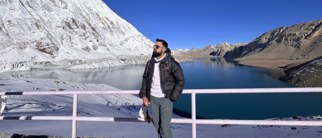
High Altitude Lakes in Nepal
Summary: High altitude lakes in Nepal sit above 4,000m, led by Kajin Sara Lake at 5,020m in the Annapurna region, followed by Imja Tsho and the Gokyo Lakes system in the Everest region. Popular treks include Tilicho Lake and Ice Lake, while sacred sites like Gosaikunda and Damodar Kunda draw Hindu and Buddhist pilgrims. Climate change has expanded glacial lakes significantly, raising GLOF risk and requiring careful acclimatisation planning.
Understanding High Altitude Lakes in Nepal
Imagine standing beside a crystal-clear lake, where snow-capped peaks of the Himalayas rise behind you. The air is crisp, the water calm, and the scenery unlike anything you’ve ever seen. These moments define the high altitude lakes in Nepal, where nature’s raw beauty meets spiritual tranquillity.
For many travellers, discovering serene escapes far from crowded tourist spots can be challenging. Furthermore, what if there was a destination where nature’s grandeur and tranquil solitude came together perfectly? Moreover, planning a trek to these remote locations requires accurate information about routes, permits, and seasonal conditions.
Welcome to Nepal’s high altitude lakes, hidden gems scattered across the Himalayas that reward trekkers with breathtaking mountain views, quiet surroundings, and deeply rewarding journeys. With Nepal Hiking Adventure, this guide explores the most remarkable lakes of Nepal, explaining their locations, access trekking routes, and essential travel tips so you can plan confidently. From remote glacial lakes to sacred alpine waters reached on demanding high-altitude treks, these destinations offer a rare blend of natural beauty, cultural meaning, and true Himalayan solitude.


What Makes a Lake High Altitude
High altitude lakes in Nepal generally sit above 4,000 metres, where oxygen levels drop significantly and temperatures remain cold year-round. Additionally, the altitude threshold matters because it affects both ecological characteristics and trekking difficulty. Consequently, these destinations require proper acclimatisation and careful planning before you set out.
| Elevation Range | Characteristics | Examples |
| 4,000-4,500m | Partially frozen in winter, accessible | Ice Lake, Damodar Kunda |
| 4,500-5,000m | Frozen most of year, challenging treks | Gokyo Lake, Tilicho Lake |
| Above 5,000m | Extreme conditions, expert-level | Kajin Sara Lake, Imja Tsho |
Glacier lake formations occur through distinct geological processes in the Himalayas. First, retreating glaciers leave behind depressions that fill with meltwater, creating proglacial systems. Second, moraine-dammed lakes develop when natural debris walls trap water from melting ice. Furthermore, seasonal changes dramatically affect water levels. Indeed, many lakes shrink during winter and expand in summer months.
The difference between these formations is significant. Glacial lake systems have expanded rapidly due to climate change, while moraine-dammed lakes pose a higher risk of sudden outburst floods. Meanwhile, freshwater lakes at lower elevations remain more stable year-round. Additionally, temperature fluctuations create unique ice patterns on the surface.
List of Major High Altitude Lakes in Nepal
The highest lakes in the country offer diverse experiences. These range from spiritual pilgrimages to extreme altitude challenges. Notably, each lake is situated in unique terrain that attracts different types of travellers. Below is a quick reference guide to help you identify which destination suits your trekking goals.
| Lake | Elevation (m) | Region | Notes |
| Kajin Sara | 5,020 | Manang, Annapurna | Discovered 2019, highest confirmed |
| Imja Tsho | 5,010 | Solukhumbu, Everest | Glacial, expanding |
| Tilicho | 4,919 | Manang, Annapurna | Most visited high lake |
| Gokyo Lakes (upper) | ~4,700–5,000 | Solukhumbu, Everest | Sacred cluster, Ramsar site |
| Ice Lake (Kicho Tal) | 4,620 | Manang, Annapurna | Annapurna side trek |
| Tsho Rolpa | 4,580 | Dolakha, Rolwaling | Monitored for GLOF risk |
| Gosaikunda | 4,380 | Rasuwa, Langtang | Sacred, pilgrimage site |
| Panch Pokhari | 4,100 | Sindhupalchok | Group of five holy lakes |
These represent the 10 highest lakes in Nepal that trekkers can access through established routes. Additionally, each lake is located in different regions of Nepal, offering varied landscapes and cultural experiences.
Detailed Profiles of High-Altitude Lakes
Kajin Sara Lake: Highest Lake in Nepal
Kajin Sara Lake holds the title of the highest lake in Nepal at 5,020 metres. Consequently, this makes it one of the most challenging destinations for experienced trekkers. Additionally, the discovery of Kajin Sara Lake is relatively recent, making this lake is one of the least visited due to its extreme altitude and technical route requirements.
Geographic Setting
Location Details:
- District: Manang, Nepal
- Region: Annapurna region
- Altitude: 5,020 meters (16,470 feet)
- Position: North of the Annapurna Circuit
- Terrain: Remote glacial terrain surrounded by dramatic peaks
- Note: The lake lies in Nepal’s Annapurna region in the Manang district of Nepal
- Discovery: Relatively recent
- Status: One of the least visited lakes due to extreme altitude
- Access Point: Via Tilicho Base Camp and high passes
Trekking Access
- Duration: 18-21 days from Kathmandu
- Physical Requirements: Excellent fitness levels with superior conditioning required
- Technical Requirements: Ice-walking equipment essential during certain seasons
- Guide Requirements: Experienced Sherpa guides mandatory
- Acclimatization: Multiple rest days throughout the journey
- Best Season: Late spring (May–June) or early fall (September–October)
- Route Classification: Technical route with extreme altitude challenges
Highlights
- Panoramic views of the Annapurna massif and Gangapurna peaks
- Pristine glacial waters rarely disturbed by visitors
- Challenging photography opportunities from extreme light conditions
- Wildlife sightings include Himalayan blue sheep in natural habitat
- Remote wilderness experience
Imja Tsho: Everest Region Glacial Lake
Imja Tsho sits at 5,010 metres in the Solukhumbu district of Nepal, formed by glacial retreat over the past six decades.
Location Details
- District: Solukhumbu, Nepal
- Region: Everest region
- Altitude: 5,010 meters (16,437 feet)
- Position: Above Island Peak Base Camp
- Note: The lake stands above Island Peak Base Camp
- Visibility: Clearly visible from Dingboche and Chhukung villages
- Circuit: Part of the greater Everest Base Camp trek
- Permit Required: Sagarmatha National Park permit
Formation and Growth
- Formation Period: Began in the 1960s as Imja Glacier retreated
- Expansion: By the 1990s, it had expanded to over one square kilometre
- Classification: One of the biggest glacial lakes in Nepal
- Monitoring: Closely monitored by scientists
- Risk Factor: GLOF (Glacial Lake Outburst Flood) concerns
- Growth Rate: Dramatic expansion over six decades
Safety Considerations
- GLOF monitoring systems installed by government agencies
- Local communities trained in early warning procedures
- Trekkers must follow official guidelines carefully
- Camping directly below lake’s outlet area prohibited
- Downstream flooding concerns for communities
- Regular scientific monitoring ongoing
Gokyo Lakes: Series and System Overview
The Gokyo Lakes comprise a series of six oligotrophic lakes in the Solukhumbu district. The main lake (Dudh Pokhari) reaches approximately 5,000 metres. This system represents the world’s highest lake collection, or more precisely, the world’s highest freshwater lake system on Earth. This beautiful lake system offers stunning turquoise waters against white peaks.
The Six Lakes System
| Lake Name | Local Name | Elevation | Special Feature |
| First Lake | Longpongo | 4,690 m | Entry point, teahouses nearby |
| Second Lake | Taboche Tsho | 4,790 m | Largest surface area |
| Third Lake | Dudh Pokhari | ~5,000 m | Main Gokyo Lake, settlement |
| Fourth Lake | Thonak Tsho | 4,870 m | Deepest of the series |
| Fifth Lake | Ngozumpa Tsho | 4,990 m | Longest glacial lake |
| Sixth Lake | Gyazumpa Tsho | 5,100 m | Rarely visited, pristine |
Location and Features
- District: Solukhumbu, Nepal
- Region: Everest region
- Water Color: Stunning turquoise against white peaks
- Water Type: Oligotrophic (nutrient-poor, clear water)
- System Status: World’s highest freshwater lake system on Earth
- Accessibility: More accessible than Kajin Sara Lake or Imja Tsho routes
Gokyo Ri Viewpoint
- Altitude: 5,357 metres (17,575 feet)
- Views: Panoramic perspectives of Everest, Lhotse, Makalu, and Cho Oyu
- Climb Duration: 2-3 hours from Gokyo village
- Highlight: Sunrise views considered the journey’s highlight by many trekkers
- Requirements: Good acclimatization essential
Access and Facilities
- Trek Duration: 12-14 days from Lukla
- Route Type: Well-established teahouse route
- Permits Required: Sagarmatha National Park permit and TIMS card
- Best Seasons: March to May and September to November
- Infrastructure: Comfortable journey with good facilities
- Starting Point: Lukla airport
- Note: When you visit Gokyo Lake, you’ll find this infrastructure particularly helpful

Tilicho Lake: Annapurna’s Alpine Gem
Tilicho Lake at 4,919 metres is often cited as one of the highest lakes at its altitude range. Tilicho Lake is one of the most photographed alpine destinations in the Annapurna region and attracts thousands of trekkers annually.
Location Details
- Region: Annapurna region, Nepal
- Altitude: 4,919 meters (16,138 feet)
- Length: 4 kilometres
- Water Color: Vivid blue-green (varies with sunlight and season)
- Circuit Position: Side trek from main Annapurna Circuit
- Status: One of the most photographed alpine destinations
- Annual Visitors: Thousands of trekkers
Trek Details
- Route Type: Side trek from main Annapurna Circuit
- Duration: 3-4 extra days from Manang village
- Path Characteristics: Steep ascent with exposed sections
- Base Camp: Tilicho Base Camp provides basic accommodation
- Starting Point: Manang village
- Route Classification: Popular but challenging
Scenery and Environment
- Surrounding Features: Dramatic glacial basins
- Note: The lake is surrounded by dramatic glacial basins with towering peaks
- Peaks: Tilicho Peak (7,134 m) and Nilgiri mountains surrounding the lake
- Spring Conditions: Snow-covered slopes contrast with deep blue waters
- Autumn Conditions: Clearer skies, better photography, lower temperatures
- Water Depth: Variable depending on season
- Landscape: Alpine glacial environment
- Journey Reward: When you finally reach Tilicho, the views justify every step
Myth and Legend
- Religious Association: Connected to Hindu Ramayana epic
- Mythology: Some believe it was created by Lord Ram’s arrow seeking water, while others say Shiva created this lake in ancient times
- Sacred Status: Held sacred by local communities
- Pilgrimages: Annual visits during full moon periods
- Spiritual Merit: Devotees visit this lake for religious significance

Ice Lake (Kicho Tal): Hidden Alpine Waters
Ice Lake, locally known as Kicho Tal, lies at an altitude of 4,620 metres above Manang village in the Annapurna region.
Location Details
- Local Name: Kicho Tal
- Altitude: 4,620 meters (15,157 feet)
- Position: Above Manang village
- Region: Annapurna region, Nepal
- Size: Smaller alpine lake
- Accessibility: Shorter trek option compared to other high-altitude lakes
Key Features
- Trek Type: Day hike from Manang
- Duration: 6-8 hours round trip
- Views: Annapurna range and Gangapurna
- Water State: Often frozen until late spring
- Facilities: Limited, bring all supplies
- Purpose: Excellent acclimatization for Thorong La Pass crossers
- Difficulty: Suitable for those wanting high-altitude experience without multi-week commitment
Tsho Rolpa: Glacial Lake of Rolwaling
Tsho Rolpa in the Dolakha district at an elevation of 4,580 metres ranks as one of Nepal’s largest lakes by volume.
Location Details
- District: Dolakha, Nepal
- Region: Rolwaling Valley
- Altitude: 4,580 meters (15,026 feet)
- Position: East of Kathmandu
- Valley: Remote Rolwaling Valley
- Formation: Behind moraine dam
- Classification: One of the biggest glacial lakes in the region
Formation and Risk
- Growth Period: Substantial expansion since the 1950s
- Dam Type: Moraine dam
- Risk Level: Classified as potentially dangerous glacial lake
- Monitoring: Continuous monitoring required
- Drainage Systems: Installed to reduce flood risks
- Downstream Risk: Communities below require protection
- Volume: One of Nepal’s largest by water volume
Rolwaling Valley Trek
- Trek Duration: 12-16 day expedition
- Route: Through Sherpa villages
- Equipment Required: Camping gear for certain sections
- Remoteness: Remote valley location
- Starting Point: East of Kathmandu
Environmental Significance
- Climate Evidence: Clear evidence of climate change impacts in Himalayas
- Water Levels: Fluctuate seasonally
- Glacier Status: Trakarding Glacier continues retreating
- Scientific Interest: Ongoing studies of glacial retreat
- Risk Mitigation: Drainage systems to reduce flood danger
- Note: The lake provides clear evidence of climate change impacts, while another famous lake in Nepal is Rara Lake, which sits at a different elevation
Damodar Kunda: Mustang’s Sacred Pool
Damodar Kunda comprises a series of small lakes at approximately 4,500 meters in Upper Mustang. These holy lakes are held sacred by both Hindu and Buddhist pilgrims.
Location Details
- Region: Upper Mustang, Nepal
- Altitude: Approximately 4,500 meters (14,764 feet)
- Formation: Series of small lakes
- Access Route: Via Lo Manthang
- Status: Restricted area with limited annual visitors
Religious Importance
- Hindu Association: Connected to Lord Vishnu
- Pilgrimage Site: Janai Purnima festival destination
- Religious Features: Prayer flags and religious artifacts
- Guardians: Local Loba people protect sacred waters
- Spiritual Significance: Deep religious importance for both Hindu and Buddhist traditions
- Ritual Use: Ceremonies and rituals performed by devotees
- Cultural Richness: Remote location adds to spiritual experience
Access Requirements
- Special Permit: Mustang permit required (expensive compared to other regions)
- Visitor Limits: Restricted area with limited annual visitors
- Best Seasons: Spring and autumn only (severe winter conditions)
- Cost: Higher permit costs than most other regions
- Regulations: Strict access control
Chharka Tsho: Remote Dolpa High Lake
Chharka Tsho in the Dolpa district sits at 4,500 metres in one of Nepal’s most isolated regions.
Location Details
- District: Dolpa, Nepal
- Altitude: 4,500 meters (14,764 feet)
- Region: Upper Dolpa circuit
- Remoteness: One of Nepal’s most isolated regions
- Tourism Status: Largely untouched by mainstream tourism
- Cultural Experience: Authentic high-desert community life
Community Significance
- Local Role: Lifeline for surrounding high-desert communities
- Water Supply: Provides water for agriculture and livestock
- Cultural Importance: Central to local community survival
- Environment: High-desert alpine setting
Route Characteristics
- Trek Difficulty: Extremely remote; thorough preparation required
- Infrastructure: Limited facilities and accommodation
- Circuit: Part of Upper Dolpa circuit
- Suitability: Experienced trekkers seeking solitude
- Skills Required: Self-sufficiency and advanced trekking experience
- Challenge Level: Tests trekkers’ skills significantly
Rishi Kunda: Sacred Lake of Langtang
Rishi Kunda at 4,500 metres in the Rasuwa district of Nepal holds religious significance for Hindu pilgrims.
Location Details
- District: Rasuwa, Nepal
- Region: Langtang Valley area
- Altitude: 4,500 meters (14,764 feet)
- Setting: Pristine alpine environment
- Access: Via challenging trails from Langtang Valley
- 2015 Earthquake: Area affected, recovery efforts continue
Trekking Considerations
- Crowd Level: Less crowded than Gosaikunda route
- Physical Requirements: Good physical condition necessary
- Terrain: Challenging
- Teahouse Options: Limited, advance planning required
- Combined Route: Can be combined with Langtang Valley trek for extended itinerary
- Religious Significance: Important for Hindu pilgrims
- Recovery Status: Post-earthquake reconstruction ongoing
High Altitude Lakes and Trekking Routes
Nepal offers numerous routes to reach this lake or that, each with varying difficulty levels and time requirements. Consequently, choosing the right trek depends on your experience, fitness level, and available time. Moreover, understanding permit requirements and seasonal conditions is essential for safe travel. The diversity of regions of Nepal means each trek offers unique landscapes.
Everest Region Routes
Gokyo Lake Trek
The Gokyo Lake lies in the Khumbu region, offering a spectacular alternative to the standard Everest Base Camp trek route. The duration spans 12-14 days from Lukla. The maximum altitude reaches 5,357 m at Gokyo Ri. Difficulty ranges from moderate to advanced. Six Gokyo Lakes with expansive vistas of the mountains are among the highlights. Required permits include Sagarmatha National Park and a TIMS card.
Imja Tsho Access
This forms an extension from the Everest Base Camp trek. Add 2-3 days to the standard EBC itinerary. Technical sections near Island Peak require careful navigation. Therefore, an experienced guide is essential due to glacial lake hazards. The lake is still expanding, making route conditions changeable.
Annapurna Region Routes
Tilicho Lake Trek
Duration requires 3-4 days as a side route from the Annapurna Circuit. The starting point is Manang village. Altitude gain measures approximately 1,500 m from Manang. Challenges include steep sections and landslide-prone areas. Additionally, Tilicho Lake Base Camp offers basic lodges for those who visit Tilicho Lake.
Kajin Sara Lake Expedition
Duration extends to 18-21 days total. The route passes via Annapurna Circuit to Tilicho Base Camp, then through high passes. Difficulty reaches expert level only. Requirements include ice equipment and technical climbing skills. Therefore, professional Sherpa guides are essential for safety.
Ice Lake Day Hike
The starting point is Manang village. Duration covers 6-8 hours round trip. It serves as a perfect acclimatization hike. Consequently, no overnight stay is required for this accessible day trip.
Rolwaling Valley Trek
Tsho Rolpa Lake Trek
Duration spans 12-16 days from Kathmandu. The remote valley features limited facilities. The route passes through traditional Sherpa villages. Therefore, camping is required for certain sections. The best season runs from April to May and September to October.
Mustang and Dolpa Routes
Damodar Kunda Pilgrimage
An Upper Mustang restricted area permit is required (expensive). Duration extends 14-18 days from Jomsom. High-desert landscapes characterise the terrain. Cultural immersion with Loba communities enriches the experience. Therefore, limited teahouses make camping recommended.
Chharka Tsho Trek
This ranks among Nepal’s most remote treks. Duration requires 20-25 days. The combination of the Dolpo and Mustang regions creates unique landscapes. Extensive preparation and supplies are necessary. Therefore, the route suits experienced trekkers seeking isolation.
Planning Your Trek
Permit Requirements
| Trek Destination | Required Permits | Approximate Cost |
| Gokyo Lakes | Sagarmatha NP, TIMS | $50-60 USD |
| Tilicho Lake | ACAP, TIMS | $40-50 USD |
| Damodar Kunda | Mustang RAP, ACAP | $500+ USD |
| Tsho Rolpa | Local permits | $20-30 USD |
Guide and Porter Considerations
Hiring local Sherpa guides supports communities financially. Guides provide safety expertise and cultural insights. Porter services reduce physical burden at altitude. Additionally, reputable agencies ensure proper insurance coverage for staff.
Seasonal Planning
Warmer weather and rhododendron blooms are features of spring (March–May). Autumn (September-November) delivers clear skies and stable weather. Monsoon (June-August) requires avoiding most treks due to landslides. Meanwhile, winter (December-February) creates extreme cold with many passes closed.
Best Time to Visit High Altitude Lakes
Timing your trek to Nepal’s high altitude lakes significantly impacts safety, visibility, and overall experience. The altitude and weather patterns in the Himalayas create narrow windows for optimal trekking conditions. Consequently, understanding seasonal variations helps you plan effectively. This knowledge prevents potentially dangerous situations.
Spring Season (March-May)
Spring offers warming temperatures and blooming landscapes at lower elevations. This makes it the most popular season for high altitude lake treks. The lakes begin thawing, revealing stunning colours after winter’s grip. Moreover, visibility improves as winter storms subside. However, afternoon clouds can still obscure mountain views.
Advantages
Tilicho Lake and Gokyo Lakes become accessible by late March. Rhododendron forests bloom along lower trek sections. Longer daylight hours benefit photography enthusiasts. Additionally, moderate temperatures at altitude make hiking comfortable.
Challenges
Crowded trails appear, especially on Annapurna and Everest routes. Higher lodge prices occur during peak season. Some lakes remain partially frozen in early spring. Meanwhile, afternoon clouds may limit mountain views temporarily.
Autumn Season (September-November)
Autumn provides the clearest skies and most stable weather conditions for trekking in Nepal. After monsoon rains wash the atmosphere, mountain views become extraordinarily sharp. Furthermore, temperatures remain comfortable for high-altitude travel. However, nights grow cold as winter approaches.
Advantages
Crystal-clear views of Himalayan peaks dominate the landscape. Stable weather patterns bring minimal precipitation. All major trek routes become fully accessible. Additionally, festival season adds a cultural dimension to journeys.
Challenges
Peak tourist season means crowded trails and lodges. Booking accommodations in advance is strongly recommended. Prices increase significantly during October. Meanwhile, cold nights at altitude require proper gear.
Monsoon and Winter Considerations
Monsoon (June-August)
Heavy rains create landslide risks throughout the mountains. Leeches become common at lower elevations. Cloud cover obscures mountain views consistently. Some lakes, like Tilicho Lake, remain technically accessible but not recommended. However, rain-shadow areas (Mustang, Upper Dolpo) remain feasible options.
Winter (December-February)
Extreme cold grips high-altitude lakes. Many passes close due to heavy snow. Gokyo Lakes and Tilicho Lake freeze largely solid. Limited lodge operations restrict trekking options. Consequently, only lower-altitude treks remain advisable during these months.

Altitude Sickness and Acclimatization
Altitude sickness, or Acute Mountain Sickness (AMS), poses the primary health risk when trekking to high-altitude lakes in Nepal. The condition occurs when you ascend too quickly for your body to adjust to reduced oxygen levels. Consequently, proper acclimatization schedules are non-negotiable. Safe travel above 3,500 metres demands careful planning.
Common Symptoms
Headache and dizziness affect most trekkers initially. Nausea and loss of appetite follow commonly. Fatigue and difficulty sleeping disrupt rest. Additionally, shortness of breath during exertion limits activity levels.
Prevention Strategies
Ascend gradually using the principle “climb high, sleep low”. Add acclimatization days every 1,000 metres above 3,000 m. Stay hydrated with 3-4 litres daily. Avoid alcohol and sleeping medications. Therefore, recognise symptoms early and descend if necessary.
Critical Acclimatization Points
| Trek | Key Acclimatization Stops | Recommended Rest Days |
| Gokyo Lake | Namche Bazaar, Dole | 2-3 days |
| Tilicho Lake | Manang, Tilicho Base Camp | 2-3 days |
| Tsho Rolpa | Na Village | 1-2 days |
Safety Notes and Environmental Issues
Trekking to high-altitude lakes in Nepal requires awareness of both personal safety and environmental responsibility. The remote locations and extreme altitude present unique challenges that demand preparation and respect. Moreover, climate change impacts these fragile ecosystems. Sustainable practices remain essential for preservation.
Altitude Sickness Management
Beyond prevention, knowing when to descend can save lives. Mild AMS symptoms may improve with rest and hydration at the same altitude. However, worsening conditions require immediate descent. This applies even at night if necessary.
Warning Signs Requiring Immediate Descent
A severe headache unresponsive to medication demands action. Confusion or difficulty walking straight indicates serious problems. Fluid buildup in lungs produces crackling sounds when breathing. Therefore, extreme fatigue preventing movement requires evacuation.
Emergency Protocols
Descend at least 500 metres immediately when symptoms worsen. Seek medical attention at the nearest health post. Helicopter evacuation is available from major trekking regions. Consequently, comprehensive travel insurance is essential for all trekkers.
Glacial Lake Outburst Flood Risks
Glacial Lake Outburst Floods (GLOFs) represent a growing environmental hazard in Nepal. Climate change accelerates glacier melting significantly. Lakes like Imja Tsho and Tsho Rolpa have expanded substantially. This increases pressure on moraine dams. Consequently, monitoring systems track water levels and dam stability continuously.
High-Risk Lakes
Imja Tsho receives continuous monitoring with drainage systems installed. Tsho Rolpa features government-installed drainage to lower water levels. Additionally, Lower Barun Glacial Lake shows rapid expansion based on observations.
Trekker Safety
Follow local authority warnings and restricted zones carefully. Avoid camping in valleys directly below large glacial lakes. Check recent conditions with guides before departing. Therefore, respect barrier zones and monitoring equipment installations.
Responsible Travel and Conservation
The increasing popularity of high-altitude lake treks puts pressure on fragile Himalayan ecosystems. Trekkers play a crucial role in minimising environmental impact through conscious choices. Furthermore, supporting local communities ensures sustainable tourism development around the lake areas.
Leave No Trace Principles
Carry out all non-biodegradable waste without exception. Use designated toilet facilities or proper burial techniques. Avoid disturbing wildlife or removing natural objects. Additionally, stay on established trails to prevent erosion.
Supporting Local Communities
Hire local guides and porters to support economies. Purchase supplies from village shops when possible. Respect cultural sites and photography restrictions. Therefore, learn basic Nepali phrases for respectful interaction.
Cultural and Religious Significance
Many high-altitude lakes in Nepal hold deep spiritual meaning for local communities and pilgrims. These sacred waters attract devotees who undertake challenging journeys for religious merit. Consequently, trekkers should approach these sites with cultural sensitivity. Awareness of ongoing religious practices shows respect.

Sacred Lakes of the Himalayas
Gosaikunda Lake
Gosaikunda Lake, while not covered in detailed profiles, sits at 4,380 metres and represents one of Nepal’s most important pilgrimage sites. Thousands of Hindu and Buddhist devotees visit the lake during the Janai Purnima festival in August. The lake is also believed to have been created by Lord Shiva’s trident. Legend says the lord bathed in this lake when he plunged his trident into the mountain.
Damodar Kunda
These lakes in Mustang are associated with Lord Vishnu. They attract pilgrims despite the remote location. The journey itself is considered an act of devotion. Additionally, many elderly devotees undertake the challenging trek. Local Loba people maintain the site and assist pilgrims.
Rishi Kunda
Named after the seven sages (Rishis) of Hindu tradition, this lake sees less pilgrim traffic than Gosaikunda. However, it holds similar reverence. The surrounding area features prayer flags and small shrines. Therefore, visitors leave offerings as signs of devotion.

Festivals and Pilgrimages
Janai Purnima (July-August)
This full moon festival draws thousands to sacred lakes across Nepal. Male Hindu devotees change their sacred threads (janai). Both Hindus from Nepal and India perform ritual bathing together. Despite falling during monsoon, pilgrims consider the journey essential. Consequently, spiritual cleansing drives these dangerous treks.
Local Ceremonies
Throughout the year, Sherpa and Tamang communities perform smaller ceremonies at various lakes. These may include offerings to local deities. Blessing ceremonies occur before trekking seasons. Annual water rituals maintain spiritual connections. Therefore, trekkers who encounter these ceremonies should observe respectfully from a distance. Participation requires invitation from community members.
Cultural Etiquette
Remove shoes before approaching shrine areas. Walk clockwise around the lake during sacred circumambulation. Avoid pointing feet toward religious objects. Request permission before photographing ceremonies. Additionally, refrain from loud behaviour near sacred waters.
Comparisons and Facts
Understanding how Nepal’s highest altitude lakes compare globally provides valuable context. These lakes represent extraordinary natural phenomena shaped by geology, climate, and elevation. Moreover, comparing different lake types helps trekkers choose destinations. This matches their interests with appropriate challenges.

Highest Lakes: Nepal vs World
Kajin Sara Lake, at 5,020 metres ranks as Nepal’s highest lake. It also stands as one of the highest lakes in the world. However, several lakes in other regions sit at even greater elevations.
| Lake | Elevation (m) | Location | Type |
| Ojos del Salado pool | 6,390 | Chile/Argentina | Crater |
| Lhagba Pool | 6,368 | Tibet | Glacial |
| Ridonglabo Lake | 5,801 | Tibet | Glacial |
| Kajin Sara Lake | 5,020 | Nepal | Glacial |
| Gurudongmar Lake | 5,183 | India (Sikkim) | Glacial |
Despite not holding the absolute record for the world’s highest lake, Kajin Sara Lake is the highest accessible through established trekking routes. The Chilean and Tibetan lakes require technical mountaineering skills or special permits.
Glacial vs Freshwater Lakes
Nepal contains both glacier lake formations fed by melting ice and freshwater lakes sustained by precipitation and springs. The distinction affects water temperature, clarity, and ecological characteristics. Furthermore, glacial lakes typically display that signature turquoise colour. This comes from suspended rock flour.
Glacial Lake Characteristics
These lakes of Nepal are fed primarily by glacier meltwater. Distinctive blue-green colouration marks them clearly. Colder water temperatures persist year-round. Higher mineral content affects ecosystems. Additionally, subject to GLOF risks, they require monitoring. Examples include Imja Tsho, Tsho Rolpa, and Gokyo Lakes.
Freshwater Lake Characteristics
Fed by precipitation, springs, or rivers, these support more diverse ecosystems. Clearer or darker water appears depending on depth. They support more varied aquatic life. More stable water levels reduce flood risks. Therefore, examples include Phoksundo Lake and Rara Lake.
Phoksundo Lake deserves special mention. At 145 metres deep, it’s Nepal’s deepest lake. Located at an altitude of 3,611 metres in Dolpo, Shey Phoksundo Lake displays stunning turquoise waters. Its pristine setting makes it a popular trekking destination. The lake is a freshwater lake despite its appearance suggesting glacial origins. Additionally, the lake includes species of unique aquatic life adapted to high altitudes.
Seasonal Variations and Water Levels
High-altitude lakes in Nepal experience dramatic seasonal changes. These affect their appearance and accessibility significantly. Variations result from temperature fluctuations, precipitation patterns, and glacial melting rates. Consequently, the same lake can appear vastly different. Spring and autumn visits reveal contrasting scenes.
Winter (December-February)
Most lakes freeze completely or partially solid. Water levels reach annual minimum depths. Ice thickness can exceed one metre. Additionally, limited trek access occurs due to snow accumulation.
Spring (March-May)
Ice begins breaking up by late March progressively. Meltwater increases lake volumes steadily. Water levels rise throughout the season. Therefore, glacial flour creates peak turquoise intensity.
Monsoon (June-August)
Precipitation adds substantial water volume. Cloudy waters result from increased sediment. Glacial lakes expand to maximum size. Meanwhile, difficult observation results from weather conditions.
Autumn (September-November)
Water levels gradually decrease from summer peaks. Clearest visibility and colour intensity emerge. Stable conditions benefit photography enthusiasts. Therefore, the ideal trekking window precedes the winter freeze.
Climate Change Impacts
Studies show many glacial lakes in Nepal have expanded significantly since the 1960s. Imja Tsho has grown from a small pond to over one square kilometre in surface area. Similarly, Tsho Rolpa continues expanding as the Trakarding Glacier retreats. These changes underscore the urgency of monitoring programmes. Consequently, sustainable trekking practices become more critical annually.
Notable Lakes at Lower Elevations
While this guide focuses on high-altitude lakes, several of the best lakes in Nepal sit at lower elevations. These deserve mention for their beauty and accessibility. They provide excellent alternatives for those unable to trek at extreme altitudes.
Rara Lake
Rara Lake is the biggest lake in Nepal by surface area. Nepal is Rara Lake’s home in the remote Karnali Province. The largest lake in Nepal spans 10.8 square kilometres. Located at an altitude of 2,990 metres, it remains accessible year-round. Additionally, the lake on Earth here displays pristine alpine beauty. Moreover, the lake in Nepal is Rara when discussing the country’s largest natural water body.

Phewa Lake
Phewa Lake in Pokhara stands as the second largest lake in Nepal. This lake in Pokhara sits at 742 metres elevation. It serves as the centrepiece of Nepal’s tourism capital. The lake reflects the Annapurna range magnificently. Therefore, among popular lakes are Phewa and Begnas, both near Pokhara.
Begnas Lake
Begnas Lake lies 15 kilometres from Pokhara at 650 metres elevation. This freshwater lake offers peaceful surroundings. It remains less crowded than Phewa Lake. Additionally, the lake is a freshwater system supporting rich biodiversity.
Birendra Lake
Birendra Lake is a freshwater glacial lake in the Manaslu region of Gorkha District, Nepal.
Birendra Lake is a freshwater glacial lake located in Nepal’s Gorkha District’s Manaslu area.
Named after the late King Birendra Shah, it forms from the Manaslu Glacier near Samagaun village. Positioned at a high altitude of about 3,691 metres (12,110 ft), it serves as a key acclimatization point on the Manaslu Circuit Trek, with deep spiritual significance for local communities.
Kak Bhusundi Lake
Kak Bhusundi Lake in the Manang region holds mythological significance. Named after a sage, it attracts both trekkers and pilgrims. Additionally, the lake lies along popular trekking circuits.

High Altitude Lakes in Nepal: Final Thoughts
High altitude lakes in Nepal offer a unique combination of natural beauty, cultural significance, and trekking adventure. These qualities make them essential stops for any traveller seeking both challenge and serenity. From the highest lake in Nepal at Kajin Sara to the spiritual waters of Damodar Kunda, each destination presents unforgettable experiences. Moreover, these lakes of Nepal showcase the raw power of Himalayan geology. They serve as vital indicators of climate change impacts simultaneously.
Whether you’re trekking to a remote alpine lake or watching Himalayan peaks reflect in calm waters, these lakes of Nepal create moments of awe. They foster a deep connection with the Himalayas. The journey itself transforms travellers through traditional mountain villages and high passes. It provides insights into mountain cultures. Furthermore, responsible trekking practices ensure these fragile ecosystems remain pristine. Future generations will experience and cherish them.
Plan your visit to these stunning high-altitude lakes in Nepal today. Prepare thoroughly with proper acclimatization schedules, required permits, and experienced guides. Share your experiences with fellow trekkers. Let us know which lake in the Gokyo system or lake in the Annapurna region excites you most! Contact us at Nepal Hiking Adventure to begin crafting your perfect Himalayan lake trek itinerary.

High Altitude Lakes in Nepal: FAQs
Which is the highest lake in Nepal?
Kajin Sara Lake, at 5,020 metres, holds the title of Nepal’s highest lake. The lake is located in the Manang district of the Annapurna region. This glacial lake requires expert-level trekking skills to reach this lake safely. Proper ice equipment is essential for the journey.
What is the best time for high altitude lake trekking?
The ideal seasons are spring (March–May) and fall (September–November). These seasons provide stable weather and accessible routes throughout regions of Nepal. Autumn delivers clearer mountain views specifically. Spring features blooming landscapes at lower elevations beautifully.
Are permits required to visit high-altitude lakes?
Yes, most high-altitude lakes in Nepal require trekking permits. These depend on location and protected area status. For example, Gokyo Lake requires Sagarmatha National Park permits. Tilicho Lake needs ACAP permits. Damodar Kunda demands expensive restricted area permits for Upper Mustang.
Which lakes are best for beginners?
Ice Lake (Kicho Tal) from Manang offers the most accessible high-altitude experience. It requires just a day hike from the village. Gokyo Lakes also suits moderately fit trekkers with proper acclimatization. Tilicho Lake presents intermediate challenges suitable for those with some trekking experience.
How dangerous are glacial lake outburst floods?
Glacial lake outburst floods pose real risks in Nepal. This applies particularly to expanding lakes like Imja Tsho and Tsho Rolpa. However, government monitoring systems and drainage projects have reduced immediate dangers. Trekkers following established routes and local warnings face minimal risk.
What is the difference between Gokyo Lake and Tilicho Lake?
Gokyo Lake sits at approximately 5,000 metres in the Everest region. It forms part of a six-lake system with excellent infrastructure and easier access. Tilicho Lake lies at an altitude of 4,919 metres in the Annapurna region. It’s often cited as one of the world’s highest lake systems. Reach Tilicho Lake via a more challenging side trek with limited facilities.
Can I visit these lakes without a guide?
While independent trekking is technically allowed on some routes, hiring experienced local guides significantly improves safety. Guides provide crucial acclimatization advice at extreme altitudes. They navigate challenging terrain expertly. They offer cultural insights, particularly for remote destinations. These include Tsho Rolpa or Chharka Tsho specifically.
What is the duration of the hike to Tilicho Lake?
Tilicho Lake trek requires 3-4 additional days as a side route. This deviates from the main Annapurna Circuit starting from Manang village. The complete circuit typically takes 16-18 days from Kathmandu. This includes Tilicho Lake itself. Duration depends on your acclimatization schedule and hiking pace.
What makes Phoksundo Lake different from other high-altitude lakes?
Phoksundo Lake at 3,611 metres is Nepal’s deepest lake at 145 metres. It displays stunning turquoise waters despite being a freshwater lake. Shey Phoksundo Lake is not a glacial formation. Located in Dolpo, the lake is situated slightly below typical high-altitude classifications. However, it offers easier access and warmer conditions. These compare favourably to lakes like Gokyo or Tilicho.
Are the lakes safe for swimming?
Swimming in high-altitude lakes in Nepal is strongly discouraged. Several factors create serious risks. Extremely cold water temperatures often remain near freezing. Altitude-related health risks compound dangers. Cultural sensitivity at sacred sites requires respect. Brief immersion can cause hypothermia rapidly. The reduced oxygen at altitude makes recovery from cold shock difficult.


Our History in Service Excellence


